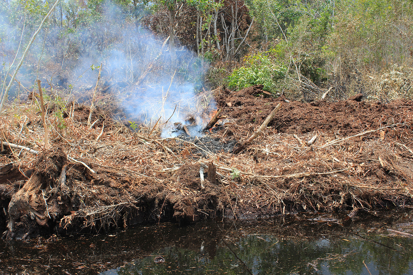
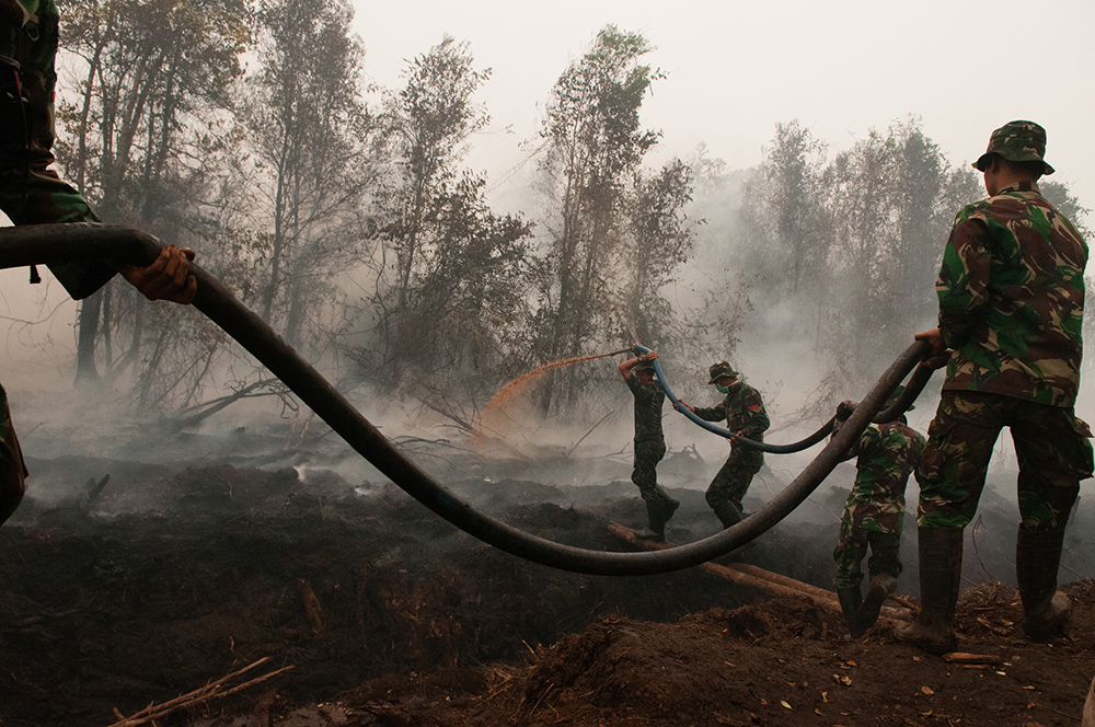
Teluk Makmur Village, located within the administrative area of Medang Kampai Subdistrict, Dumai District, Riau Province, is one of the priority locations for the restoration of 2 million hectares of peatland. A number of restoration activities have been carried out in this area. However, despite existing restoration efforts, there is still room for improvement. During a field observation, the team discovered that peat fires have occurred near the construction site for peat rewetting infrastructure.
A number of areas in Teluk Makmur have experienced fires since early 2019. Like other areas in the Province of Riau, land and forest fires in Teluk Makmur recur almost every year. Most of the fires occur on peatlands, making them difficult to extinguish.
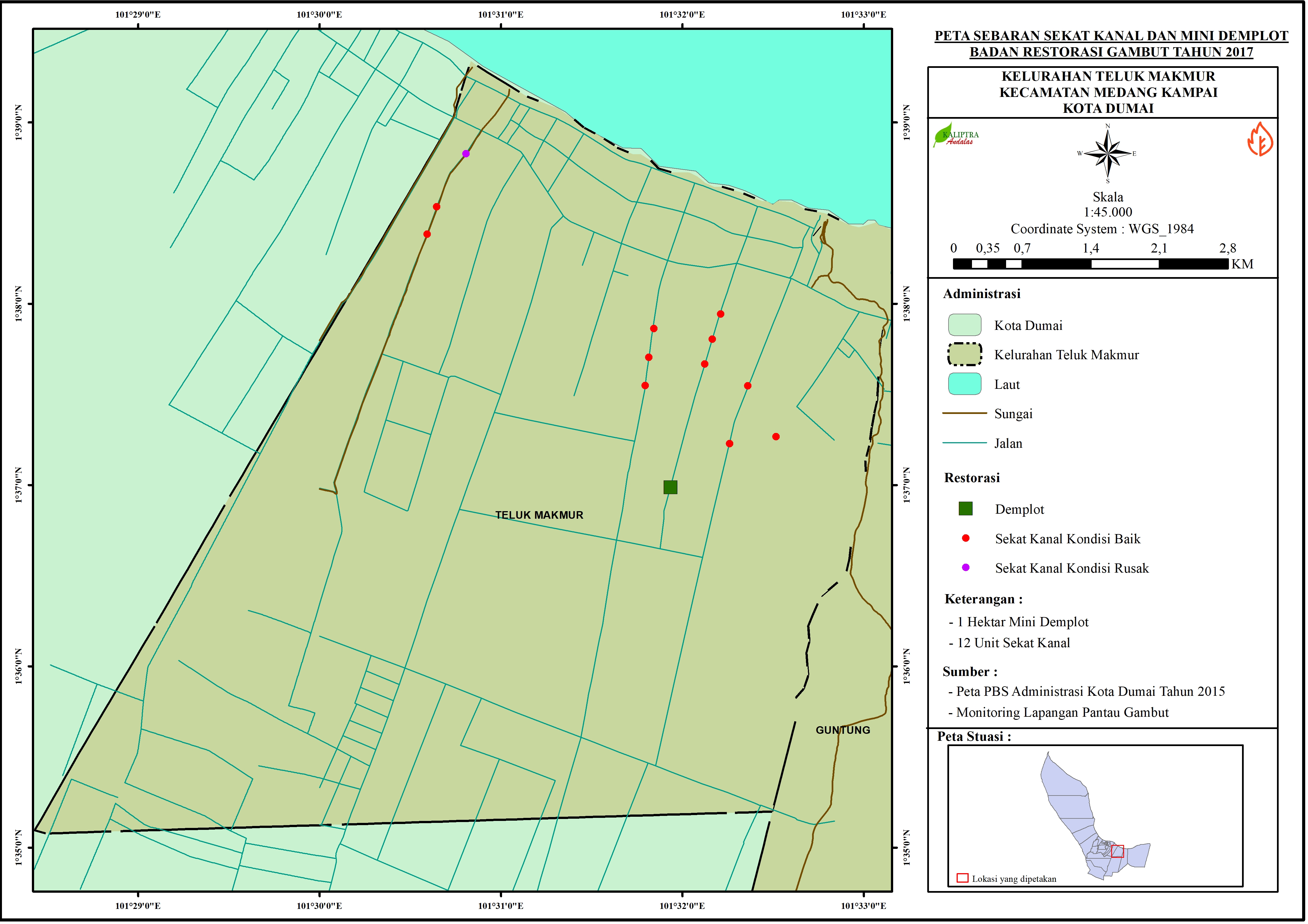
According to the national program for the restoration of 2 million hectares of peatland in the 2016-2020 period, Teluk Makmur is one of the priority areas for restoration in Riau Province. Peat restoration activities in Teluk Makmur have been running since 2017 with the construction of a number of rewetting infrastructures in the form of blocking canals, the creation of demonstration plots, and the revitalization of people’s livelihoods.
Kaliptra Andalas, which is the Network Node of Pantau Gambut in Riau, has mapped the location of the blocking canals and pilot plots. The mapping reveals that in Teluk Makmur peat restoration activities through rewetting include the construction of 12 blocking canals.
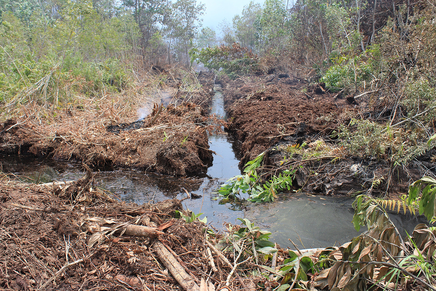
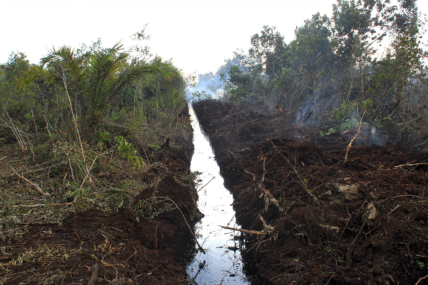
Restoration activities through rewetting, including building canals on top of existing canals in peat areas, aim to maintain the peat’s moisture level so that it does not burn easily. However, investigation by the Network Nodes team in Riau finds that this goal has not been achieved even though the canals are able to contain the flow of water.
The Riau Network Nodes Team found that a fire occurred in Teluk Makmur in a location very close to the peat rewetting infrastructure, which was a blocking canal. This fire occurred along the path with red dots marking the location of the blocking canal (see map).
At this burnt location, most of the vegetation is acacia and shrubs. There is no detailed information on the status of land ownership in this area.
This finding is based on direct observations and searches carried out by the team from March 24 to 26, 2019. Following up on these findings, a more in-depth study is necessary to examine why fires still occur in areas that should have received peat restoration interventions.


