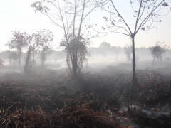
In early 2019, a number of fires were detected in the Province of Riau. Most of the land and forest fires in this area were difficult to extinguish because they occurred on peatlands. Pantau Gambut’s preliminary analysis shows that more hot spots were detected in Riau between January and March 2019 compared to the same period in 2015, where some of the worst fires occurred in Indonesia.
Beside South Sumatra and Central Kalimantan, Riau has the highest fire occurrence in Indonesia for the past 15 years. Pantau Gambut conducted an analysis of data on hot spots that have been detected in the Riau since 2015, as recorded by NASA’s VIIRS sensor. The year 2015 was selected as a starting point due to the massive land and forest fires that occurred in several regions in Indonesia, including Riau, causing haze to spread all the way to Malaysia and Singapore.
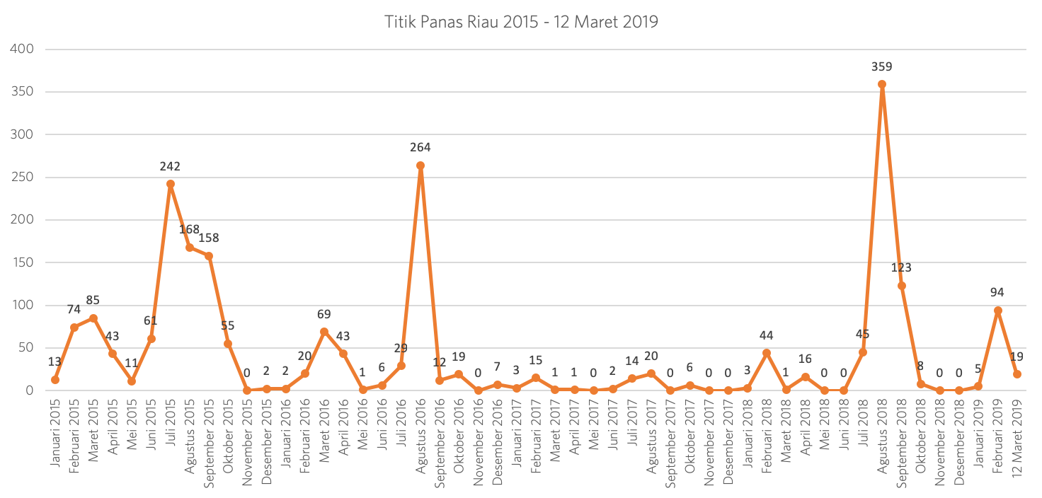
Based on summarized data from January 1, 2015 to March 12, 2019, the two periods of increased occurrence of hot spots in Riau were the first quarter of the year, between February and March, and the third quarter, between July and August.
Between 2015 to early 2019, the number of hot spots in Riau decreased in 2017, before spiking again in August 2018. The dry season, which was drier than the previous year, was the cause of the increased hot spots.
The number of hot spots in early 2019 is worrying. In total, the number of hot spots detected in February 2019 was higher than February 2015.
In February 2019, 94 hot spots were detected in Riau, as monitored by the high confidence VIIRS sensor. This was higher than the 74 hot spots detected in February 2015, moments before land and forest fires scorched 2.6 million hectares of land. The weather factor will be a formidable challenge for the prevention and handling of land and forest fires in Riau, especially due to the El Nino phenomenon that has occurred since December 2018 and is predicted to last until April. This dry condition will be very prone to fire and will be difficult to extinguish if the fire occurs on peatlands.
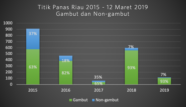
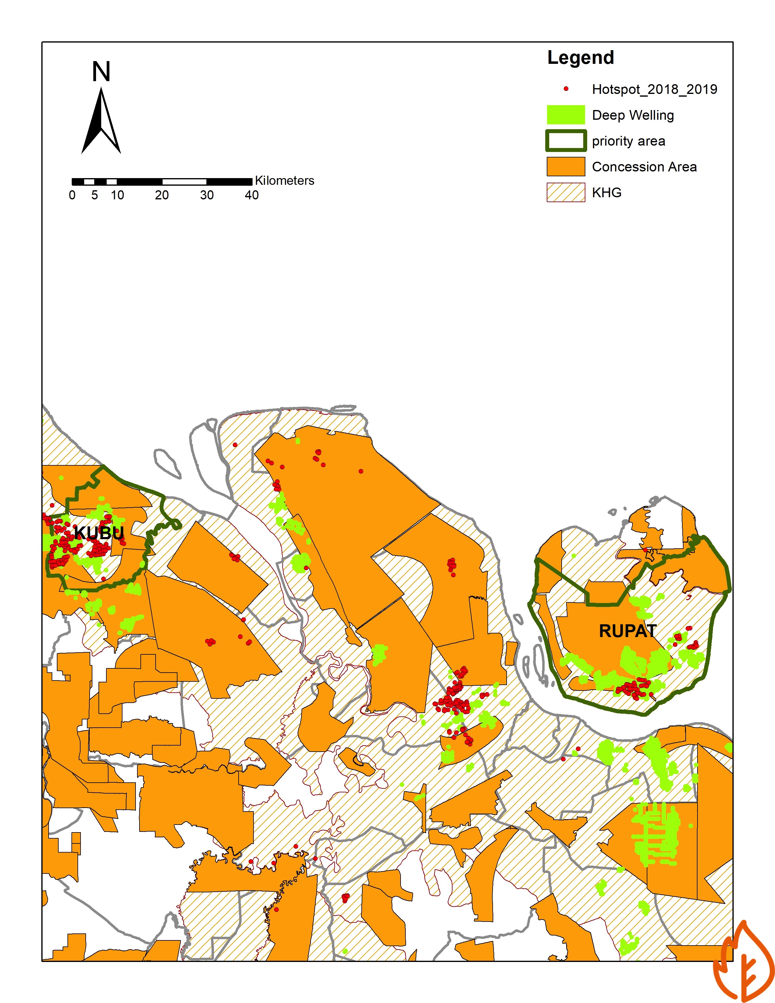
Pantau Gambut overlapped hotspots with peat maps in Indonesia. As a result, on average, 77% of all hot spots monitored in Riau between 2015 and March 12, 2019, occurred on peat areas. The percentage of hot spots on peatland by year can be seen in the following chart.
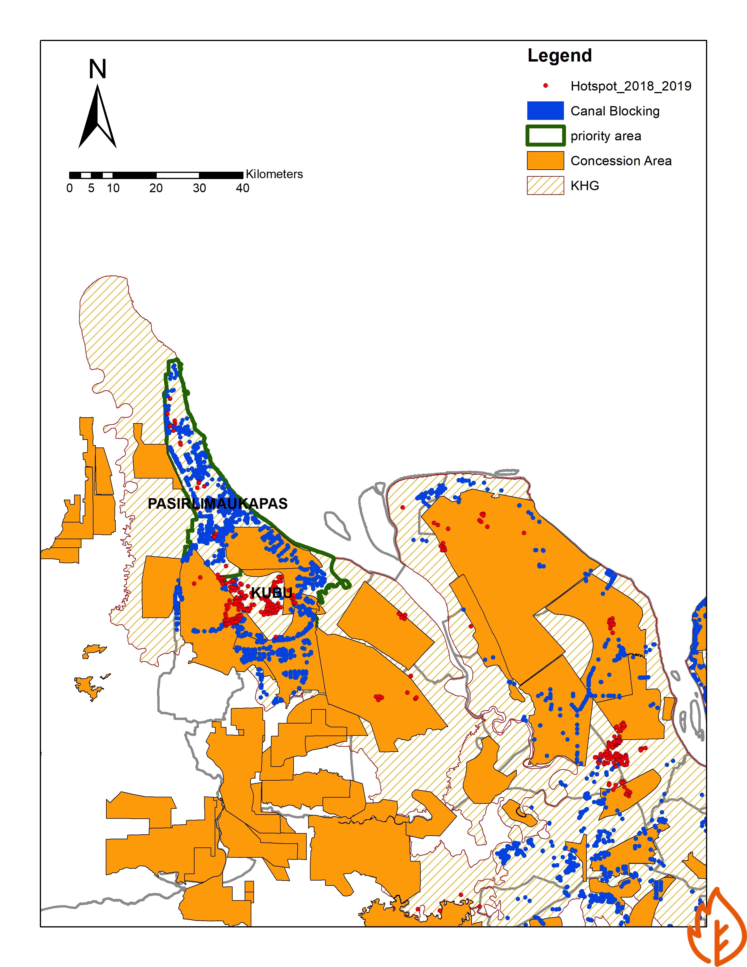
In addition, the Pantau Gambut team also overlaid the map of hot spots with the 2018 and 2019 Peatland Restoration Annual Action Plans (RTT) in Riau.
The results show that hot spots were detected in Riau between 2018 and 2019, in areas that should have received intervention from peatland restoration rewetting programs.
With this preliminary data, a more in-depth study is necessary to examine why fires still occur in peat areas that should have received restoration interventions.
Support Us
Share this information with your family and friends.


