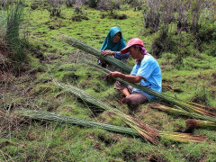
By Parliza Hendrawan
from WRI

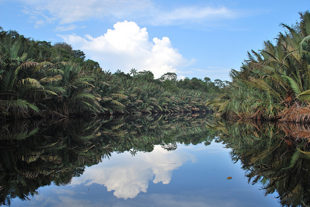
The Talang Tuwo inscription is a relic of the 7th century Srivijaya Kingdom which holds the values ​​of environmental preservation. This article is the last part of the story about the authors attempt to trace the location of the relic and the changes in the surroundings due to neglecting ancestral values.

The Talang Tuwo inscription is a valuable relic containing noble advice to protect the environment through water management. The advice on water regulation is especially evident in this text: “...and may all other plants with the dams and ponds, and all of good deeds that I've contributed can be enjoyed for the benefit of all creatures, including the ones that can move around and the ones that cannot, and may this be the best path to achieve happiness.”

According to Yenrizal, who is the deputy dean of the political science study program at UIN Raden Fatah, the Talang Tuwo inscription is one of the written local wisdoms that is still very relevant today, especially in maintaining peat ecosystems. “The Talang Tuwo inscription mentions good water management. It is clear that water management was the King's priority,” said Yenrizal.

The importance of water management had been taken into account by the King even though at that time the land was still green and water was still abundant. The inscription does not describe a good water management method but the term “dams” can be interpreted as a type of water engineering.

"But now the peatlands are drained for various purposes," he explained.

Unfortunately, people forgot the advice on water management and appropriate crop cultivation. The lands have been converted into settlements and plantations. All for the benefit of humans only. As a result, the South Sumatra region experiences fires almost every year, mostly in peatlands which are very prone to fire when dry. The smoke from peatland fires is very thick, so it often disrupts people’s activities and health.

From year to year, during the peak of the dry season, which usually occurs from August to September, several areas in Indonesia, including South Sumatra, are prone to fires. From 1 August to 3 September 2019, a total of 3,203 hotspots with a high confidence level were observed throughout South Sumatra. Based on Pantau Gambut's analysis by overlaying the hotspots map with the peat map from the Center for Agricultural Land Resources (BBSDLP), about 49.5% or 1,588 hotspots occurred on peatlands. During the remote sensing monitoring period, the highest number of hotspots on peatlands appeared on 16, 17, and 18 August 2019.

In the last few days, residents of Palembang and residents of Talang Kelapa, in particular, began to smell pungent smoke. Moreover, visibility is getting limited due to smoke from the fire sites.

Based on information from Bambang Beny Setiaji, Head of the South Sumatra Meteorology, Climatology, and Geophysical Agency’s observation and information division for the Palembang SMB II meteorological station, the smoke that enveloped Palembang City on 4 September came from hotspots in the southeastern area of Palembang, i.e. Pampangan, Tulung Selapan, Cengal, Mesuji, and Pematang Panggang in Ogan Komering Ilir District. Bambang added that the lowest visibility on the same day was in Palembang City with 1.2-1.5 km visibility and 90-96 percent humidity.

Support Us

Share this information with your family and friends.