In addition to the rainfall, flooding in these two areas are relatively slow to recede because the topography of the area is a peat swamp ecosystem. This is one of the impacts when the development of infrastructure, plantations, and housing is no longer based on local wisdom, which would have considered the surrounding natural conditions, also adding the damage caused to the peat swamp ecosystem. Floods in the respective area also lasted for relatively long periods of time.
In general, a number of authorities said that heavy rainfall is the cause of the massive flooding in South Kalimantan. In reality, rainfall is not the "main suspect" for flooding. However, regardless of the cause, based on data from the South Kalimantan Regional Disaster Management Agency (BPBD), the flood that occurred at the beginning of this year has resulted in 35 deaths, 66,768 houses submerged, affected 342,987 people, and displaced 63,603 people. This is the official data. Moreover, there are strong suspicions that the conditions in the field could be worse than what the data indicates.
Based on data from the South Kalimantan Indonesian Forum for the Environment (Walhi), the flooding was not entirely caused by rainfall. The cause is directly linked to the environmental conditions in South Kalimantan, which have entered a state of emergency.
For example, South Kalimantan Walhi‘s data, states that of the 3.7 million hectares area in South Kalimantan, only 29 percent or 670,357 hectares are free from coal mining and oil palm plantations or other permits, 6 percent or 234,492 hectares are Forest Concession Rights (HPH), 15 percent or 567,865 hectares are Industrial Plantation Forests (HTI), 33 percent or 1,219,461 hectares have mining permits, and 17 percent or 620,081 hectares have been converted as oil palm plantations.
The problem in South Kalimantan is becoming more complicated because the reclamation efforts, which is the coal mining companies’ obligation, have not been carried out. As a result, the mineshaft has become neglected.
The Mining Advocacy Network or Jatam data reveals that there are 814 unmanaged mining shafts in South Kalimantan, as follows: 5 shafts in Balangan, 8 shafts in HST, 2 shafts in HSS, 158 shafts in Banjar District, 33 shafts in Tabalong, 62 shafts in Tapin, 241 shafts in Tanah Laut, 59 shafts in Kotabaru, and 246 shafts in Tanbu.
Based on the Indonesian State Audit Board (BPK RI) audit in the first semester of 2019, 4,726 companies hold an exploration and exploitation Mining Business Permit (IUP). Out of which 282 companies have deposited their reclamation and exploitation guarantees, 983 companies have deposited their reclamation guarantees, 31 companies have deposited their post-mining guarantees, and 3,430 companies have withdrawn their second deposit.
Inevitably, the South Kalimantan region is burdened with various permits and reclamation projects that are not optimally implemented, which contributes to the flooding. In this case, there really is no other choice for the authorities, especially at the local and national level, to take fundamental and systematic steps to deal with this spatial and environmental emergency. Because if no actions are taken, similar or even greater floods might continually occur. Moreover, this year’s rainy season is expected to be a relatively long one.
At the end of the rainy season, we will be facing drought. We are certainly worried about this forecast. Given the environmental conditions in Indonesia, which are far from 'fine', the BMKG's weather forecast leaves a 'footnote': flooding during the rainy season, fire during the dry season. There is a kind of custom that we have in Indonesia, news about natural disasters is always prevalent during the rainy season.
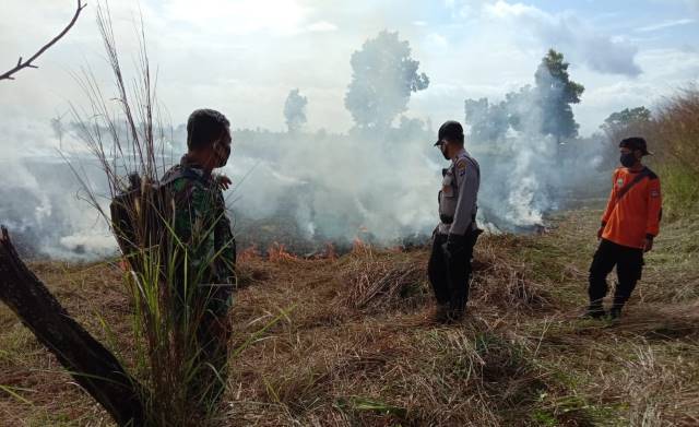
The same occurs when the dry season starts. Massive forest and land fires in the last three years seem to have been forgotten and failed to serve as valuable experiences for preparing against a similar situation. Indonesia is relatively "lucky" because the drought did not last long in 2018, 2019, and 2020. Wet droughts that lasted almost throughout the year prevented Indonesia from experiencing severe haze like in 2015, 2016, and 2017.
In this context, no massive fires occurred in the peat swamp ecosystem. The peatland in almost all areas of South Kalimantan is relatively wet and free from fires. This means that the work of the Peatland Restoration Agency (BRG), an agency established by the government to restore damaged peat areas, is relatively light. The local wisdom from the community also contributes to preventing the destruction of peat areas, which is one of the primary causes of land fires.
However, the BRG, as well as the South Kalimantan Regional Peat Restoration Team (TRGD), cannot be complacent. Because according to BMKG's forecast, the threat of a dry season is already in sight. The TRGD and BRG need to develop schemes and scenarios based on the field conditions to properly manage forest and land fires that could occur at the scale faced in the previous years.
However, the prevention and management of forest and land fires, especially in the peat swamp ecosystem in South Kalimantan, is not only the responsibility of the BRG and TRGD. The determining factor is the local government (South Kalimantan and several districts/cities with large hydrological peat areas). This is where the problem has been occurring.
Based on data published by the Peatland Restoration Agency or BRG, the total peatland area in South Kalimantan is estimated to be 103,556 hectares and the BRG’s (through the Regional Peat Restoration Team (TRGD)) restoration target is 38,762 hectares. The BRG noted that there are 18 HGU holder companies and 27,000 hectares of forest concession areas are located in peatlands in South Kalimantan. Peat restoration in a company's concession area is the company’s responsibility.
The restoration target is now directed at the concession areas in the KHG by considering the following; is a licensed concession, either HGU, IUPHHK HA/RE/HPH; the concession is not currently under legal dispute (especially in cases related to land fires); Preference will be given to those who have received a restoration order decree and already have a restoration plan in place; Preference will be given to peat areas affected by the 2015 fires and those with protected peat canals. The infrastructure construction, operation, and maintenance on concession areas are targeting a total area of 1,784,535 hectares.
The data and restoration targets are only effective if the local government is willing to cooperate, organize, and synchronize the SKPD environment and forestry-related programs with constructive efforts from the South Kalimantan BRG and TRGD.
However, this commitment and synergy may have been too late. This was due to the delay in the succession process at the local government. The 2020 local government election (Pilkada) which still undergoing legal proceedings at the Constitutional Court (MK) has resulted in a delayed appointment of the new government. The Constitutional Court trial will take place in February 2021. This means that the various programs and agendas from the new government cannot be implemented immediately. Last but not least, South Kalimantan is currently ravaged by floods. In the future, after the flood has receded, the dry season will arrive and bring its own set of problems again. (*)
*The author is the Executive Director of the South Kalimantan Walhi and the Coordinator of Simpul Jaringan Pantau Gambut for South Kalimantan
** THIS ARTICLE WAS PREVIOUSLY PUBLISHED ON 15 FEBRUARY 2021 IN RADAR BANJARMASIN OPINION COLUMN PAGE 18 AND ONLINE MEDIA PORTAL PROKAL.co **